 Home
Home
 Out and About, with our boots on.
From what you may have read between the lines, no, physically, I am not based in Scotland. Mentally I reside there 24/7. So whenever my significant other half and I are there, we are armed with boots, backpacks, walking poles, maps, walking guides and - oh, horribly old-fashioned me - a compass.
Before enlightening you about where we get our information and how we choose our walks, I would like to make one thing perfectly clear: neither me nor my better half are seasoned walkers, with calf muscles that will dazzle all those nearby. 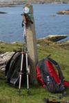 On the contrary, we have surgical scars on either back or knee, our legs are rather lily-white (so much sunshine in Scotland and there are the ticks of course) and one of us uses the walking poles to drag the body up a mountain and the other to bring trembling knees down again. I would love to be like some of my book characters (or trolls), but unfortunately I am not. And I have someone at home frequently reminding me of that as well. So there you have it. We love walking, and we love walking together. So we are not the ones to go scrambling for twelve hours. We don't do multi-day treks, climbs that involve ropes, or even hint of something dangerous. I'm totally elated if I can drag my partner out of her comfort zone one day a year, which leaves 364 days (365 in a leap year) of "regular" walks and the obligatory mental preparation for another four-boot-walk.
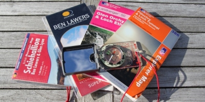 Maps, I'm a big fan. Even more, I believe in maps. Combined with a compass, they're the best way to travel between places. Mountain rescue services now have more rescues a year, because people do not carry maps and compass and rely on satnav play things only. I'm sure they can be fun, and adequate, but it can hardly be a coincidence that it is especially those with such a tool and no map who get lost.
The main and most known brand for UK maps is Ordnance Survey. They come in pink - Landranger (1:50 000 scale) - and orange - Explorer (1:25 000 scale).
The other brand with absolutely great maps is Harvey Maps, and they focus on walking/scrambling/climbing. They have Superwalker (1:25 000 scale), Mountain Map (1:40 000 scale with information on the back), Ultramap (1:40 000 scale in a handy format) and Trail map (a week's walking on one map).
Harvey maps are all waterproof; Ordnance Survey has them now in both regular and waterproof format.
 How to choose walks?
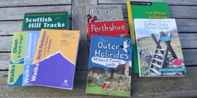
There is one amazing website several agencies and bodies refer to and it's a very, very good one: Walkhighlands. Seriously and no kidding, this is the starting point. Despite the title, it covers walks from all over Scotland. Walks that are easy-peasy or painfully and deliciously exhausting. Choose an area, a sub-area, and then walks are listed from one boot (the easy ones) to five boots. So that's Calton Hill in Edinburgh (one boot) to the In Pinn on Skye (five boots). It gives you distance and a time frame (so no average). The walks are described with starting point, bog factor, terrain, which map(s) you need... It even gives you GPS Waypoints for the play thingies. It is a really great site. I use it so much I only need to type "w" in my toolbar and the rest of the site is already displayed.
There are of course several walking guides on the market and you can see some displayed above. I particularly enjoy Ralph Storer's Munro guides (I have both regular and Baffies' versions), because they are written with a sense of humour I love and they give details for those who want to spice things up, simply stare at the scenery or take the easiest route. As said, plenty out there. And even more so to visit.
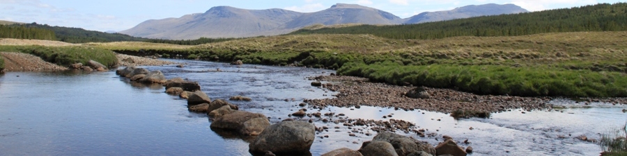
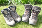
So what are you waiting for? Put those boots on, maybe double-check they are waterproof, and head out. In the menu, some of the walks we have done over the years. I will usually leave the details and the exact route to the Walkhighlands page, and will simply try to seduce you by some of the amazing sceneries we have gazed at.
